VANISHED CITYSCAPE: Satellite Images Reveal Gaza's Three-Year Collapse
Gallery
Videos
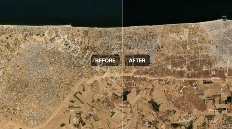
A new side-by-side satellite comparison is putting the scale of change in Gaza into stark focus, pairing imagery from September 2023 with footage from September 2026 and using a wipe transition to sweep from one scene straight into the other. The effect is jarring: entire stretches of what were once dense, built-up neighborhoods have given way to flat, cleared, or rubble-strewn land, with the transformation most visible across northern and central Gaza. Where city blocks, rooftops, and road networks once filled the frame, the newer imagery instead shows wide expanses of bare ground, the outlines of former streets sometimes the only recognizable trace of what used to be there.
The footage lines up with recent satellite-based assessments from the UN Satellite Centre, which found that roughly 82 percent of all structures across Gaza, about 200,000 buildings in total, have sustained damage since the war began in October 2023, with close to two-thirds of those destroyed outright. Updated Google Earth and commercial satellite imagery released in recent weeks has shown similar scenes in Gaza City, Khan Younis, Rafah, and the northern towns of Jabaliya and Shujaiya, where analysts say demolition and clearing operations have continued even as the broader conflict has shifted. Three years on from October 7, the satellite record offers one of the clearest, least disputable pictures yet of just how much of Gaza's urban landscape has been erased.