סענטראל פארק זעהט היסטארישע שניי
גאלערי
ווידעאס
A powerful nor’easter that began on February 23, 2026, delivered historic snowfall across the Northeast, producing record-breaking totals, widespread travel disruptions, and blizzard conditions from Pennsylvania through Maine. The storm’s intensity was underscored by exceptional accumulation figures in several major population centers.
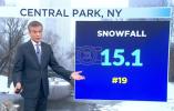
In New York City’s Central Park, snowfall reached 19 inches, marking the largest single-storm total in a decade and the most significant accumulation since 2016. The storm’s heavy, wind-driven snow reduced visibility, slowed public transit operations, and forced the cancellation of numerous flights at major regional airports. Road conditions deteriorated rapidly as plows struggled to keep pace with the snowfall rate during peak periods.
Providence, Rhode Island, experienced even more extreme conditions, recording 32 inches of snow and surpassing its previous all-time record of 26.3 inches set during the historic 1978 blizzard. The new benchmark reflects both the storm’s duration and its high snowfall intensity, which overwhelmed standard removal operations and prompted emergency measures across the city. Local authorities implemented travel restrictions as crews worked to clear primary corridors and restore access to critical services.
Blizzard warnings remained in effect across a wide swath of the Northeast, with sustained winds and drifting snow compounding the impact of the heavy accumulation. Thousands of flights were canceled or delayed, and major highways experienced temporary closures due to hazardous driving conditions and reduced visibility. Rail services also reported interruptions as ice and snow affected switching systems and track operations.
Emergency management agencies activated regional response protocols, focusing on snow removal, power restoration where outages occurred, and support for stranded motorists. Utility providers staged additional crews in anticipation of downed lines caused by the combination of wet snow and wind loading on infrastructure.
Meteorologists attributed the storm’s severity to a well-developed coastal low that intensified rapidly while drawing in cold Arctic air, creating optimal conditions for prolonged heavy snowfall. The system’s slow movement allowed snow bands to persist over the same areas for extended periods, driving up totals and increasing the likelihood of record accumulations.
As recovery operations continue, attention has shifted to clearing secondary roads, reopening transportation networks, and assessing economic impacts from the widespread shutdown. The event stands as one of the most significant winter storms in recent years for the region, with Providence setting a new historical benchmark and New York City recording its most substantial snowfall in a decade.
