האריקעין מארינע שטורעמט מיט 160 מייל פער שעה!
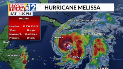
Hurricane Melissa has intensified into a Category 5 storm overnight, becoming the most powerful hurricane of the 2025 Atlantic season.
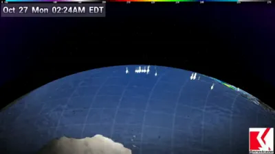
According to data from the Air Force Reserve Hurricane Hunter aircraft, Melissa’s maximum sustained winds have reached 160 mph (260 km/h), with even higher gusts recorded early Monday morning, October 27. The National Hurricane Center has confirmed the upgrade to Category 5 status, warning of “potentially catastrophic” conditions across parts of the Caribbean.
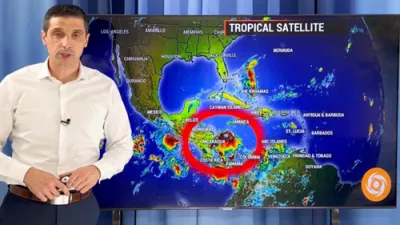
Satellite imagery from NOAA’s GOES-East shows Melissa’s rapid evolution over the past 24 hours — transforming from a disorganized cluster of storms into a perfectly symmetrical hurricane with a clearly defined eye and intense eyewall convection. Meteorologists attribute the explosive strengthening to exceptionally warm sea surface temperatures, exceeding 29°C, and low wind shear in the central Caribbean.
The storm is now bearing down on Jamaica, where authorities have issued emergency evacuation orders. Forecasts warn of rainfall totals between 15 and 40 inches, destructive winds, and life-threatening storm surges reaching up to 20 feet along coastal regions.
Melissa’s unprecedented intensification underscores growing concerns about the frequency of extreme weather events in the Atlantic, with experts pointing to climate-driven ocean warming as a key factor behind the storm’s power. Caribbean nations are now racing to prepare for the hurricane’s full impact as it continues moving northwest at alarming speed.