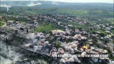
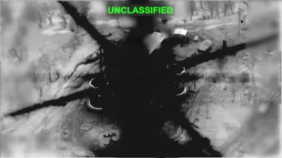
סאטעליט בילדער ווייזן מאסיווע שאדן צו א איראנע ראקעט פלאץ.
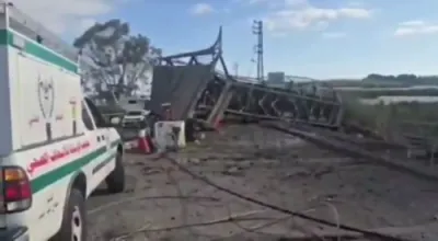
New satellite imagery has revealed extensive damage to Iran’s missile facility in Kermanshah, highlighting the impact of recent coordinated strikes. Analysis from SoarAtlas shows collapsed tunnel entrances, multiple impact craters, and widespread surface destruction across the site. The facility, located in western Iran, is known for its hardened underground infrastructure built into mountainous terrain. These features were specifically designed to protect critical missile assets from aerial attacks, making the observed damage particularly significant.
The Kermanshah complex has been a focal point in ongoing U.S. and Israeli operations targeting Iran’s ballistic missile capabilities. Since late February 2026, repeated strikes have aimed to degrade both the physical infrastructure and operational readiness of Iran’s missile program. The destruction of access points suggests an effort to render underground storage and launch systems unusable. Such targeting reflects a strategic emphasis on disrupting not just weapons stockpiles, but also the logistics that sustain them.
Satellite indicators, including collapsed entryways and crater patterns, point to precision-guided munitions designed to penetrate reinforced structures. This type of damage is consistent with efforts to neutralize deeply buried facilities that are otherwise resistant to conventional strikes. The imagery also suggests that multiple strike waves may have been conducted, compounding the level of destruction over time. Analysts note that sustained targeting increases the likelihood of long-term operational setbacks for the facility.
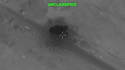
From a strategic standpoint, the degradation of the Kermanshah site represents a broader effort to limit Iran’s ability to project missile-based power across the region. Ballistic missile systems have long been a central component of Iran’s military doctrine and deterrence posture. By focusing on key nodes within this network, U.S. and Israeli forces aim to reduce both immediate threats and future development capacity. The scale of the damage observed indicates measurable progress toward these objectives.
Overall, the satellite imagery provides a clear visual assessment of the evolving battlefield beyond direct combat zones. It underscores the role of advanced reconnaissance in verifying strike effectiveness and shaping operational decisions. As tensions persist, such intelligence will remain critical in evaluating the success of ongoing campaigns. The situation at Kermanshah serves as a tangible example of how modern warfare increasingly relies on precision, persistence, and technological superiority.